Rivers and wetlands provide extremely important habitats, supporting a wide variety of unique flora and fauna, and are considered to be the most biologically diverse of all ecosystems. It is therefore critical for the future of life on our planet that these areas are nurtured and cared for with monitored, sustainable land management programmes. It is equally critical, that this is done in a considered approach with regard to flood impact on the wider area.
Hydro-GIS have become more involved with stream and river restoration projects in recent years as landowners, local nature conservation groups and wildlife trusts realise the importance of maintaining and enhancing the river environment (an example is the Earth Trust’s River of Life 2 project, restoring a stretch of the River Thames). River restoration projects give nature a helping hand in restoring a damaged river to its previous self, by kick-starting natural processes, helping it to better function. Project work can include reconnecting to a flood plain, bed level raising and re-meandering.
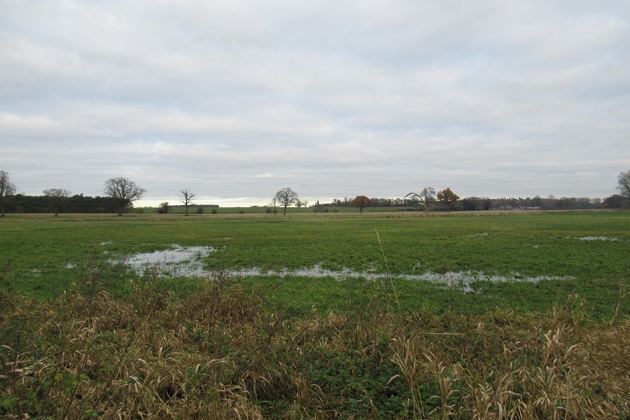
As rivers are restored and their habitats are improved, various species of animals that had been displaced by human activity can return to the area. Wetlands have also been identified as a major tool in mitigating the impacts of climate change as they are able sequester massive amounts of carbon. In order to reap these benefits for the environment without detrimental consequences, one of the key questions which needs to be addressed with river restoration is how the proposed works may change the hydrology – in particular, what would happen under flood conditions.
Flood risk
In order for a river restoration project to meet approval from the Environment Agency, it must be demonstrated that the flood risk would not be increased under the proposed restoration’s measures. Therefore, part of the initial design work involves hydrological modelling to predict the impact of flooding under the current and restored river scenarios.

Particular types of river restoration schemes could potentially have a significant impact on flooding. For example, one popular restoration option is to de-culvert sections of a waterway. This is where pipes taking the stream underground are removed and the stream is allowed to flow as an open channel. This has particular benefit for biodiversity and amenity purposes but there is a greater potential risk of flooding from an open watercourse. Therefore, modelling work needs to be undertaken to demonstrate that the open channel can provide at least the same capacity as the original piped watercourse.
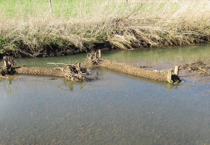
Zero Order restoration
Another type of restoration where the impact of flooding needs to be considered in detail is Zero Order restoration. This is a new approach where an existing section of a stream or river is fully or partially blocked, and part of the bank and floodplain is excavated to divert the water onto the surrounding floodplain. Another section of bank at a distance downstream is excavated with the idea that flow from the river would be conveyed onto the floodplain and, effectively, define its own course before returning to the existing channel. Under these circumstances, a detailed study (including cell based topographic modelling in GIS) is required to identify the path water would take under different flow conditions, including extreme flood flows.
GIS analysis
GIS is also used in identifying any constraints in the area where a proposed river restoration can be undertaken. For de-culverting a river, the route taken by the culvert is normally straight, but the aim for an open waterway would be to provide a natural meandering channel. The path the channel would take may be constrained by existing infrastructure, areas of particular nature conservation status, or land owned by other parties. Using GIS, such data layers can be overlain to give an optimum path for the restored waterway.

Working together
Hydro-GIS work in collaboration with other consultants who specialise in designing river restoration schemes aimed at providing wetlands for enhancing biodiversity, removal of pollutants, providing amenity value and flood control measures. Please get in touch if you have a project you would like to discuss.