8th January 2024
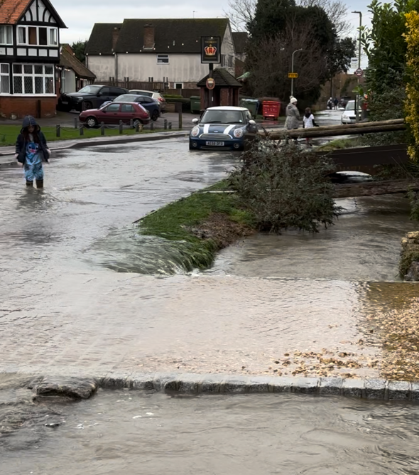
Oxfordshire, like many areas of the UK, has started 2024 with severe flooding, causing distress and disruptions in various communities.
Following a prolonged spell of wet weather and intense rainfall, on Monday 8 January, 149 flood warnings and 149 flood alerts were in place across the UK from the Environment Agency, and emergency responders were busy operating temporary pumps, barriers and flood defences to help reduce the impacts.
This recent flooding serves as a reminder of the delicate balance between urban development and environmental conservation.
Floodplains are low-lying areas adjacent to rivers that naturally collect excess water during heavy rainfall or snowmelt. They serve as a release valve for rivers, reducing the risk of flooding in urban areas. Constructing buildings or infrastructure on floodplains disrupts this natural balance, increasing the vulnerability of communities to flooding.
Community groups play a pivotal role in advocating for sustainable practices and ensuring that decisions regarding floodplain developments are made with careful consideration for the long-term well-being of the community.
- Participate in public consultations and planning meetings related to land development.
- Voice concerns and provide evidence-based insights to influence decisions favouring floodplain preservation as flood defence.
During these challenging times of flooding in our region, we understand and share your concerns about potential housing developments in areas susceptible to flooding.
We encourage local groups and concerned individuals to gather evidence responsibly to take proactive steps to document and showcase the risks associated with these locations.
Here are some important guidelines to consider:
1. Safety First: Your safety is paramount. Please do not endanger yourself or others by entering flooded areas. Stay on safe ground and do not attempt to walk, drive, or swim through floodwaters. The currents can be deceptively strong, and hazards may be concealed beneath the water’s surface.
2. Photographic Documentation: If you’re in a safe and accessible area (such as public rights of way), consider taking photographs or videos of flooded locations from a distance. These images can serve as valuable evidence to demonstrate the extent and impact of the flooding, aiding in illustrating the risks associated with potential developments in flood-prone zones.
3. Respect Property and Privacy: Ensure that you do not trespass on private property while documenting flood-affected areas. Respect the boundaries and privacy of individuals affected by the floods.
4. Use Caution: Even when capturing photos from a distance, remain vigilant and cautious of your surroundings. Avoid unstable ground or areas where the situation might change rapidly.
5. Share Responsibly: Share your documented evidence through appropriate channels, such as local authorities, community representatives, or environmental advocacy groups. Your contributions can contribute to informed decision-making regarding development in flood-prone regions.
We can work together to raise awareness and advocate for responsible urban planning that prioritises safety and mitigates the risks associated with potential housing developments in flood-prone areas.