18th October 2023
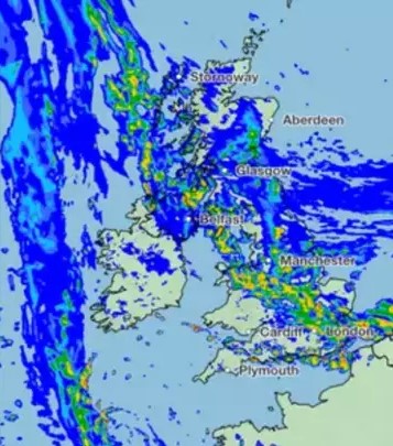
The UK Met Office has issued a red warning for rainfall in Eastern Scotland for Thursday evening into Friday afternoon. The rainfall is associated with Storm Babet which has formed over the Bay of Biscay and is currently moving northwards over southern Britain.
Due to a blocking anticyclone over Scandinavia, the Met Office are predicting the storm will become slow moving and will then develop into an east coast event in terms of the rainfall footprint classification. This is when moist air over the North Sea is brought on-shore by an easterly air stream. As this is predicted to hit the coast of Northern England and Scotland, exceptional continuous rain could be experienced over higher ground, particularly the eastern Grampians between Dundee and Aberdeen where the red warning is in force.
Such events are fairly infrequent but have caused severe flooding in the past. A depression taking a similar trajectory in August 1948 caused devastating floods in the Southern Uplands when 24-hour rainfall totals of 157mm were measured at Kelso and 141mm at Paxton Tweedhill. Numerous bridges were destroyed and landslides blocked roads and railway lines.
If you may be in the affected area, please check the live Flood Updates to keep yourself informed: https://floodline.sepa.org.uk/floodupdates/