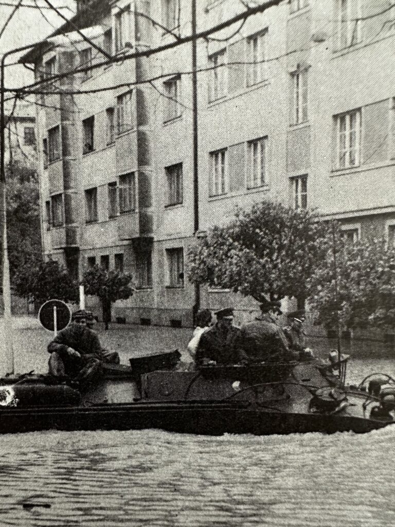
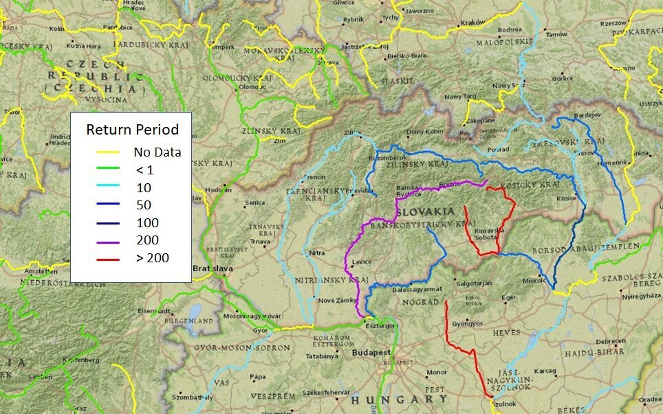
The flood event footprint data depicts the extent and severity of an actual historical flood event, such as the October 1974 floods which affected Slovakia and Hungary. The severity is based on the estimated return periods at available gauging stations on the major rivers using data from the state hydrological services.
Through the use of colour-coded mapping in GIS, these footprints can readily show the areas which were most severely affected during the flood.
The footprints have formed the basis of flood catastrophe models developed by Hydro-GIS Ltd and have been generated using flow records obtained from non-digital records, such as hydrological year books which were commonly produced by state hydrological services in the 20th century before the advent of on-line publishing.
Image credit Ziak, A. (1977) Development of Water Management in Slovakia. Ministry of Forestry and Water Management, Bratislava. (in Slovak)
The datasets are very useful for the development of new flood catastrophe models
The key output of a flood catastrophe model is to generate a set of synthetic flood events for a particular region. The flood event footprint data can provide the location and severity of affected rivers from actual events upon which the modelled event set can be based.
The flood event footprints are also ideal for flood catastrophe model review, to establish if catastrophe models have events which resemble those events known to have happened in the past. Flood catastrophe models have been developed by some companies and organisations which are based purely on mathematical relationships and produce events which are completely inconsistent in terms of the hydrology and impossible to actually occur. The resulting loss estimates from such events would be erroneous and therefore there would be no value in using and purchasing such a model.
Flood event footprint data can also help decision-makers to protect communities and infrastructure, and promote sustainable development practices in flood-prone areas.
Get in touch
Talk to us today and discover how Hydro-GIS flood data sets can help with your project.